
The thematic cartography of the Inventory of Landslide Phenomena in Italy can be consulted online via the IdroGEO platform.
The IdroGEO platform
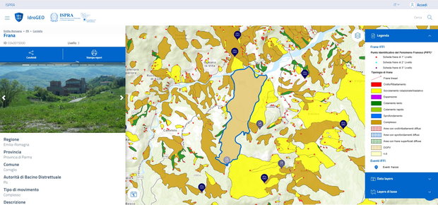
The platform allows the consultation of data, maps, reports, photos, videos and documents from the IFFI Inventory, sharing on social networks and downloading data. It is accessible with different types of device (smartphone, tablet, desktop) and is developed in open source. Its main functions are multi-user upload / update via web of the inventory landslide data by IFFI regional officials, the reporting of new landslides in the area and the creation of reports.
Idrogeo supports the most recent versions of the following Browsers*:

Web Map Service
The WMS (Web Map Service) is an interoperability and interchange tool, which allows to share geographic datasets provided and managed from different sources via the Internet. The WMS (Web Map Service) of the IFFI Inventory has been developed according to the European Directive INSPIRE 2007/2/CE (Infrastructure for spatial information in Europe) and the Open GIS Consortium specifications. Through the WMS the user can access to geographic information independently from the GIS platform and get updated and official data, without unnecessary duplication. The user can access the WMS Service through a WMS viewer, as the one provided by the INSPIRE Geo-portal, or through a GIS Desktop (e.g. ArcGIS® ESRI).
The URL of IFFI WMS Map Service is the following:
Terms of use
ISPRA or persons acting on behalf of the Institute are not responsible for the use that can be made of the information contained in the IdroGEO Platform and for any direct and indirect damages. ISPRA does not guarantee the completeness and updating of the data.
The cartographic and alphanumeric information that can be consulted constitutes a significant basic knowledge framework on landslides in Italy.
The cartographic and alphanumeric information of the Inventory of Landslide Phenomena in Italy – IFFI constitute a significant basic knowledge framework on landslides in Italy. However, for analyzes and assessments on landslide failure at detailed scales (1: 5000-1: 2000) it is necessary to integrate this information with specific studies and in situ investigations, given the possibility that there are landslides not yet recorded in the IFFI Inventory or rapidly evolving.
The data are distributed under a Creative Commons Attribution-ShareAlike 4.0 International license (CC BY SA 4.0). It is possible to reuse the dataset by quoting the source (ISPRA – Region / Autonomous Province *. Inventory of Landslide Phenomena in Italy – IFFI. Progettoiffi.isprambiente.it) and using the same license to distribute the derived data.
The user is also required to:
a) report to ISPRA any errors or omissions relating to the information contained on the site, in an effort to improve the product;
b) avoid any action / activity that could affect the full exercise of the property right and copyright of ISPRA and other data providers.
* Report the Autonomous Region / Province in which the data used fall